Search
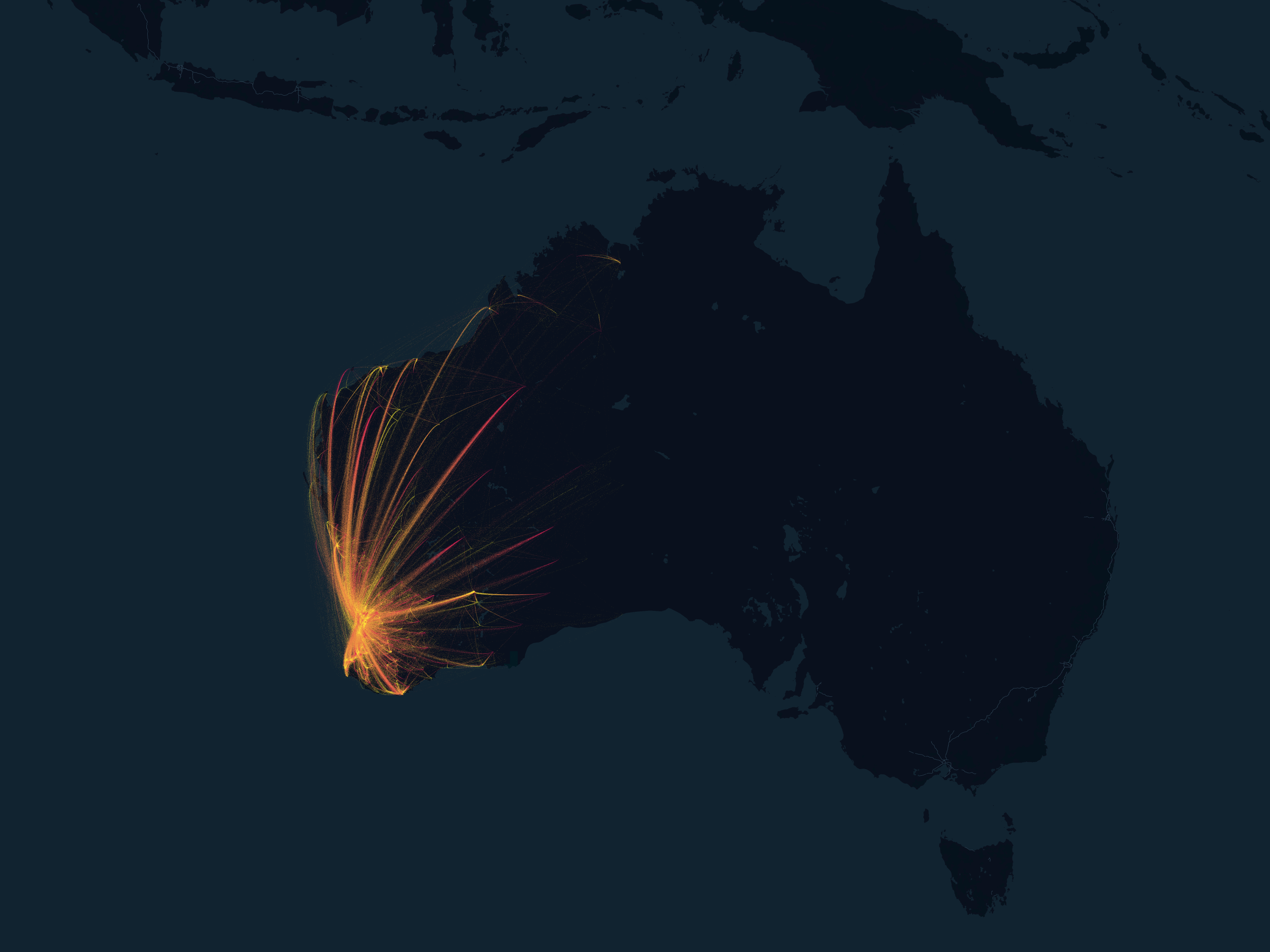
Researchers have developed a new model for simulating covid-19 outbreaks in Western Australia.
Adam Dan Saddler Weiss PhD PhD Senior Research Officer Honorary Research Fellow Daniel.Weiss@thekids.org.au Senior Research Officer Honorary
Honorary Research Associate
Access to medical treatment for fever is essential to prevent morbidity and mortality in individuals and to prevent transmission of communicable febrile illness in communities. Quantification of the rates at which treatment is accessed is critical for health system planning and a prerequisite for disease burden estimates.
Reliable and detailed data on the prevalence of tuberculosis (TB) with sub-national estimates are scarce in Ethiopia. We address this knowledge gap by spatially predicting the national, sub-national and local prevalence of TB, and identifying drivers of TB prevalence across the country.
Globally, non-communicable diseases (NCD) kill about 40 million people annually, with about three-quarters of the deaths occurring in low- and middle-income countries. This study was carried out to determine the patterns, trends, and causes of in-hospital non-communicable disease (NCD) and injury deaths in Tanzania from 2006-2015.
Low socioeconomic status (SES), high temperature, and increasing rainfall patterns are associated with increased dengue case counts. However, the effect of climatic variables on individual dengue virus (DENV) serotypes and the extent to which serotype count affects the rate of severe dengue in Mexico have not been studied before.
There has been a limited understanding of the longitudinal trajectory and determinants of socio-emotional outcomes among children in out-of-home care (OOHC). This study aimed to examine child socio-demographics, pre-care maltreatment, placement, and caregiver factors associated with trajectories of socio-emotional difficulties of children in OOHC.
To determine the incidence and incidence trends over 2001-2022 of childhood-onset type 1 diabetes (T1D) in Western Australia and assess the impact of the COVID-19 pandemic.
Human mobility is a driver for the reemergence or resurgence of malaria and has been identified as a source of cross-border transmission. However, movement patterns are difficult to measure in rural areas where malaria risk is high. In countries with malaria elimination goals, it is essential to determine the role of mobility on malaria transmission to implement appropriate interventions.